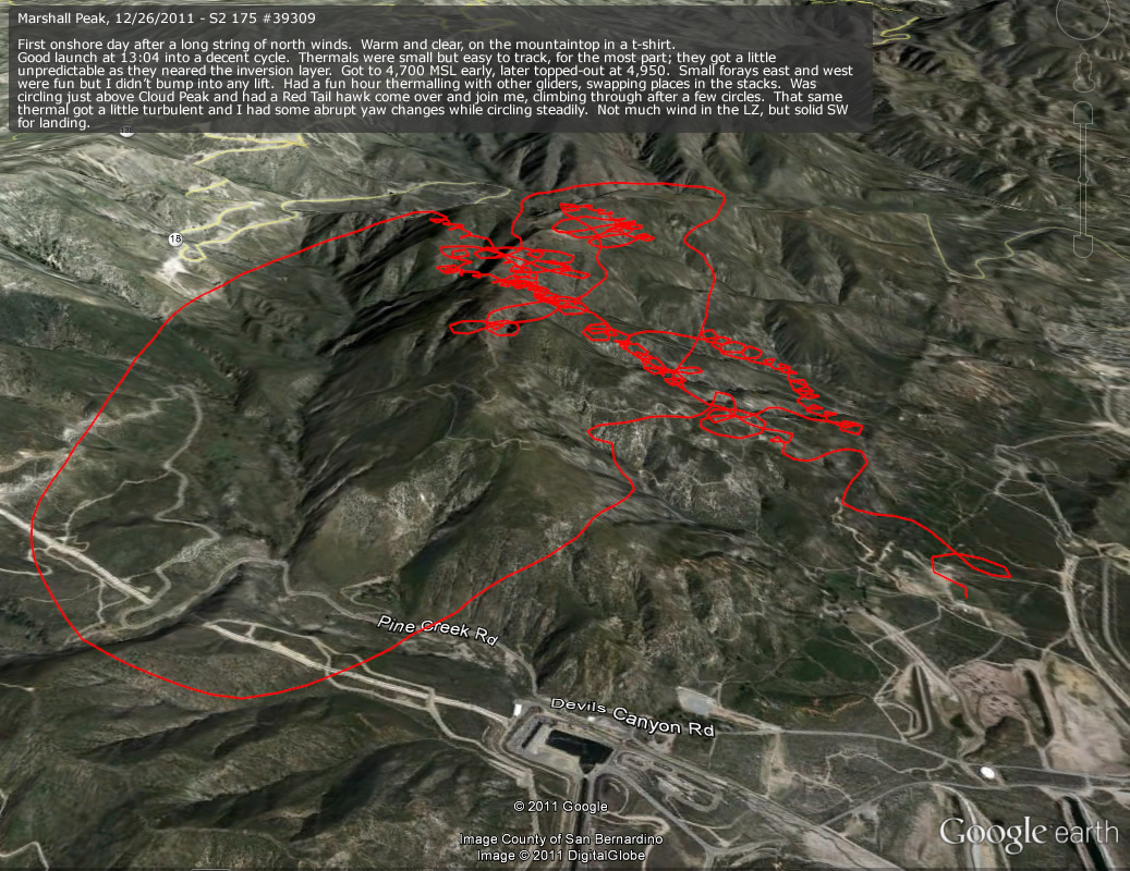
20111226: Marshall
1037 x 800
(337 KB)
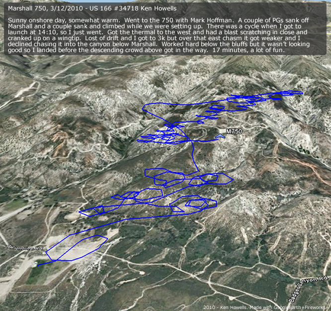
20100312: Marshall 750
666 x 627
(430 KB)
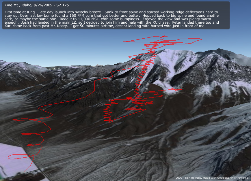
20090926: King Mt., ID
869 x 628
(374 KB)
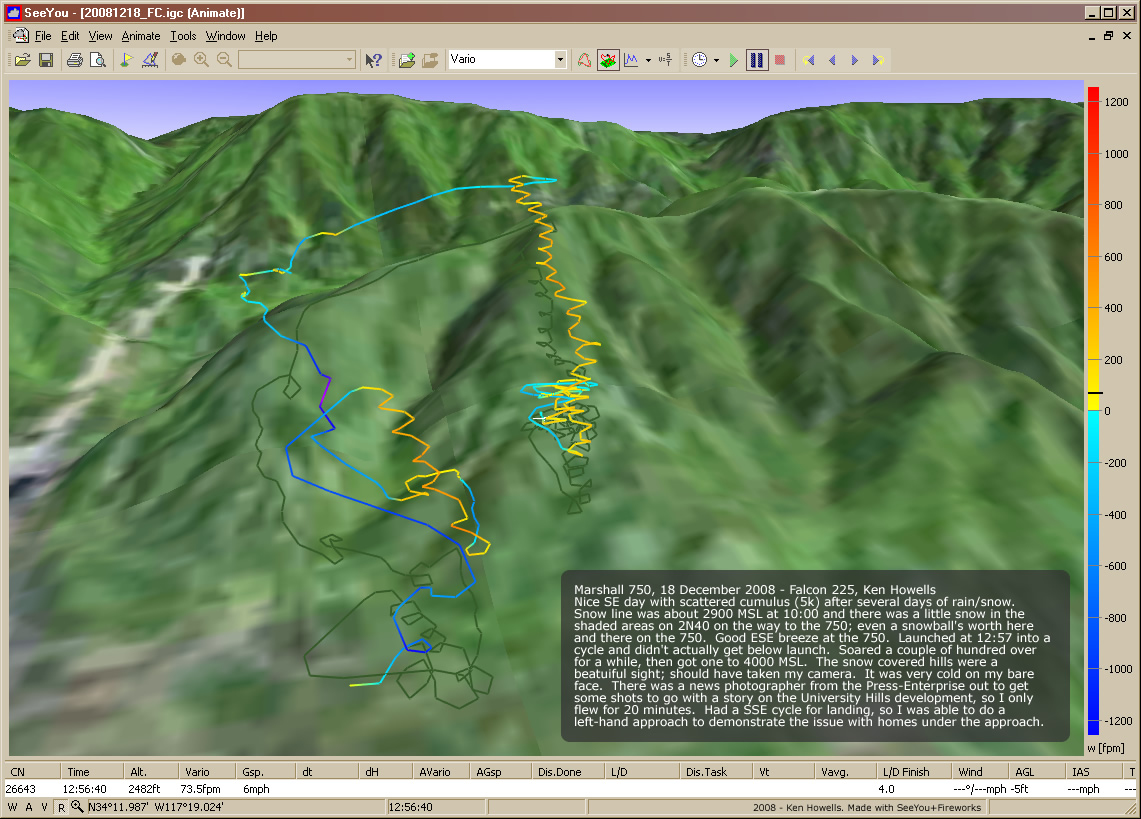
20081218: 750 to 4k
1141 x 819
(300 KB)
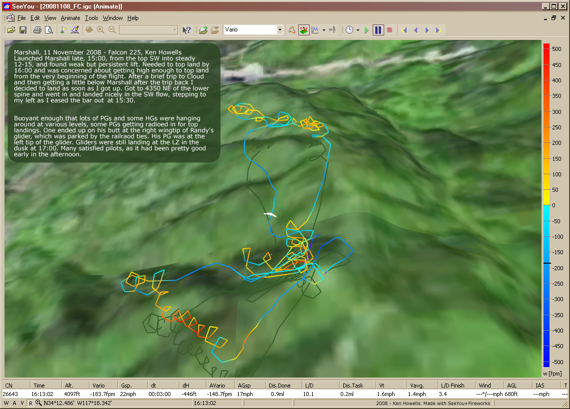
20081108: Marshall Quickie
1141 x 819
(300 KB)
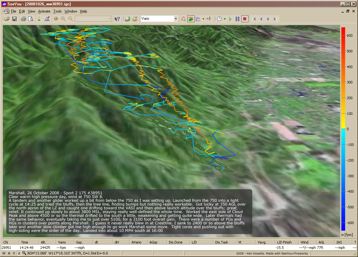
20081026: Marshall 750
1141 x 819
(377 KB)
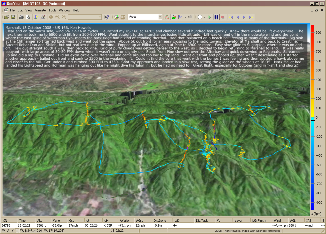
20081018: Marshall
1141 x 819
(461 KB)
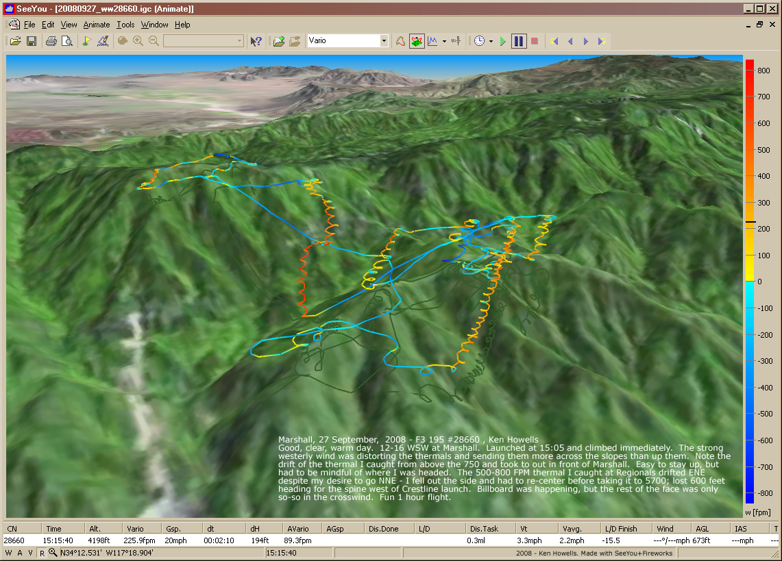
20080927: Marshall Windy
1141 x 819
(364 KB)
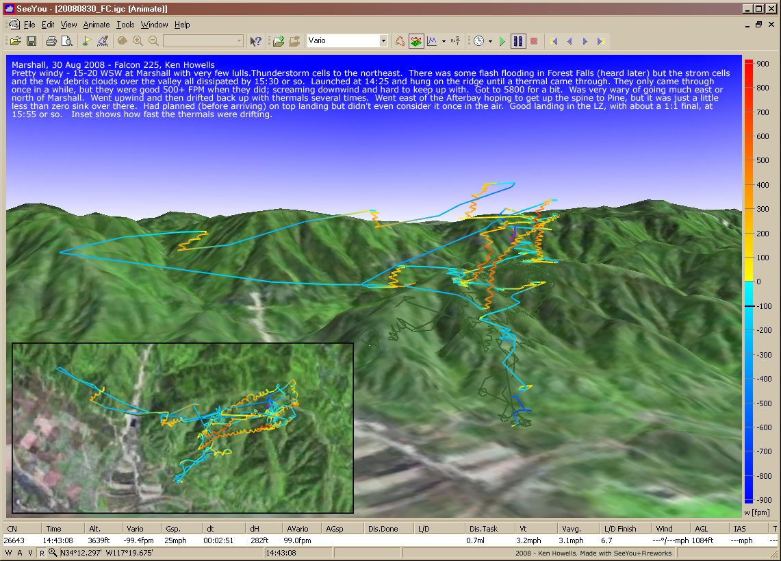
20080830: Marshall Windy
1141 x 819
(396 KB)
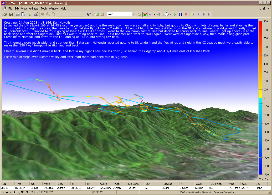
20080824: The 750
1141 x 819
(407 KB)
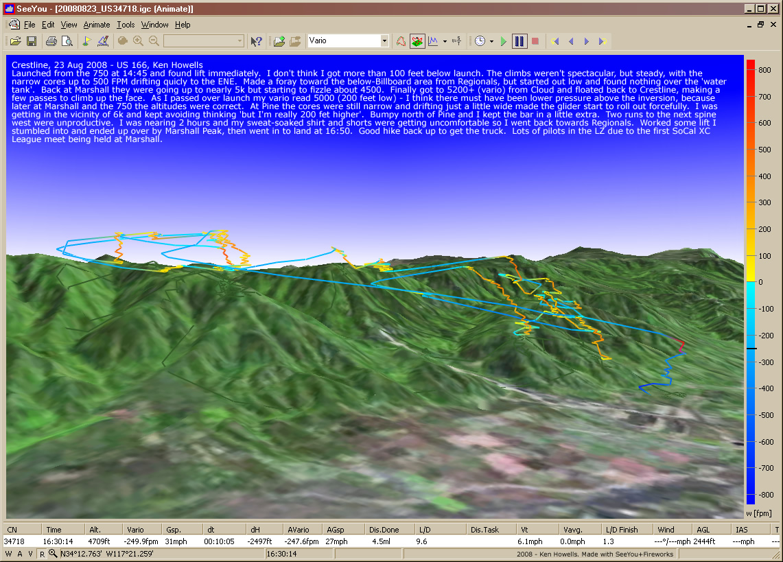
20080823: The 750
1141 x 819
(414 KB)
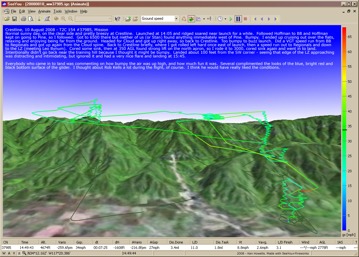
20080810: Crestline
1141 x 819
(420 KB)
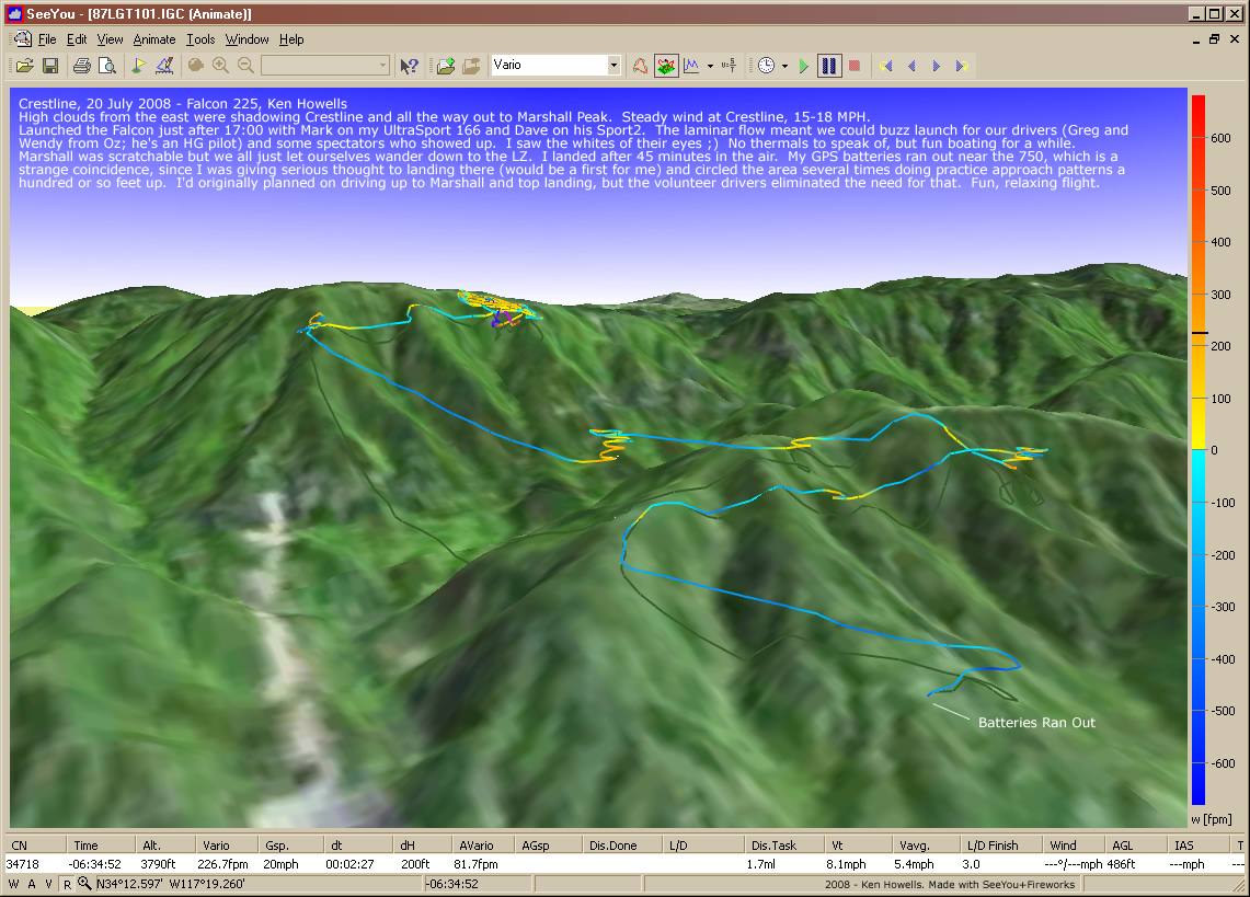
20080720: Crestline
1141 x 819
(328 KB)
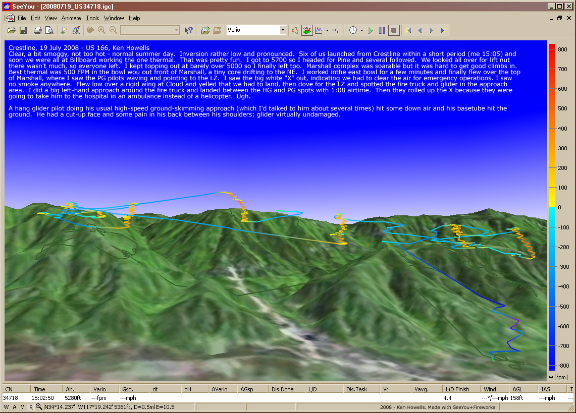
20080719: Crestline
1141 x 819
(413 KB)
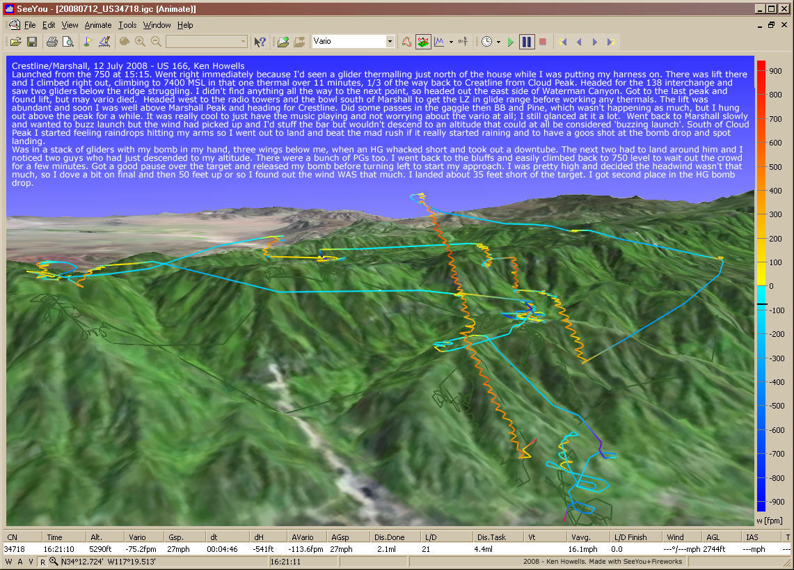
20080712: AJ Airpark
14th Anniversary Fly-In
14th Anniversary Fly-In
1141 x 819
(511 KB)
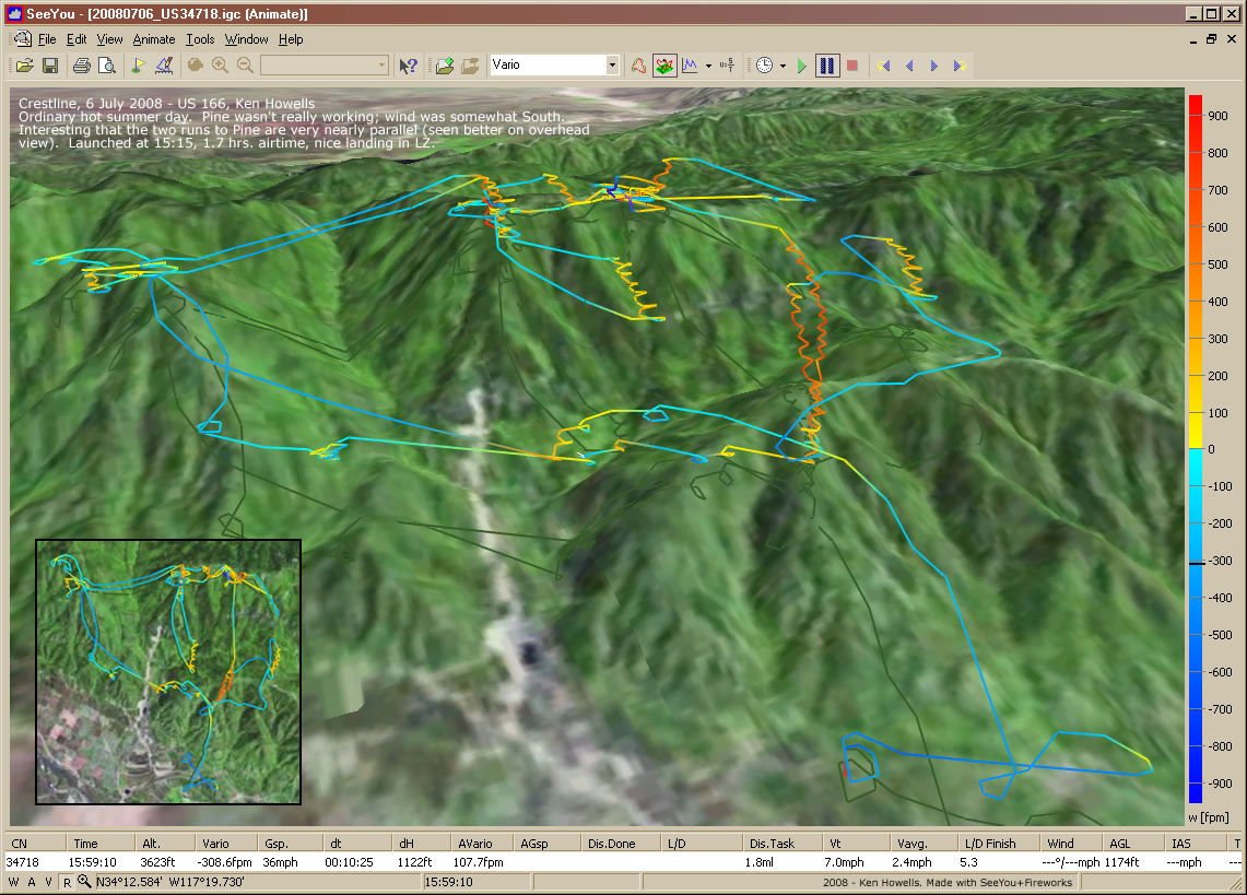
20080706: Crestline
1141 x 819
(370 KB)

20080622: Crestline
1141 x 819
(379 KB)
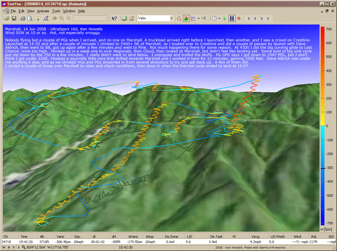
20080614: Marshall
1100 x 819
(379 KB)
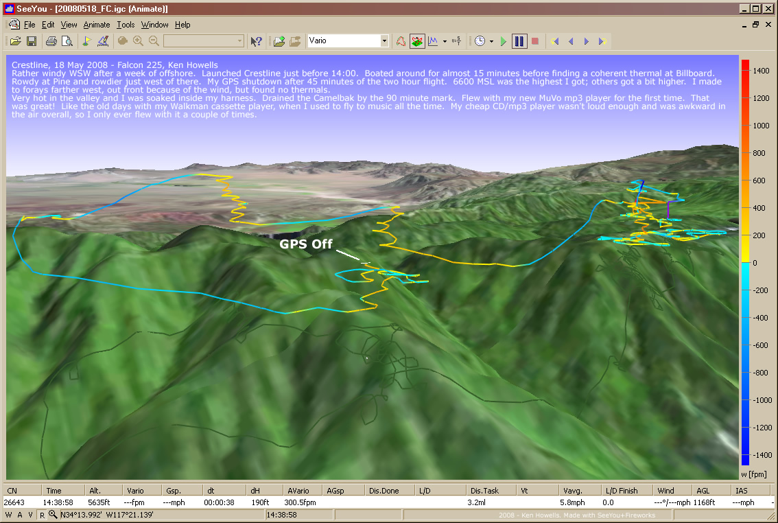
20080518: Crestline
1134 x 762
(320 KB)
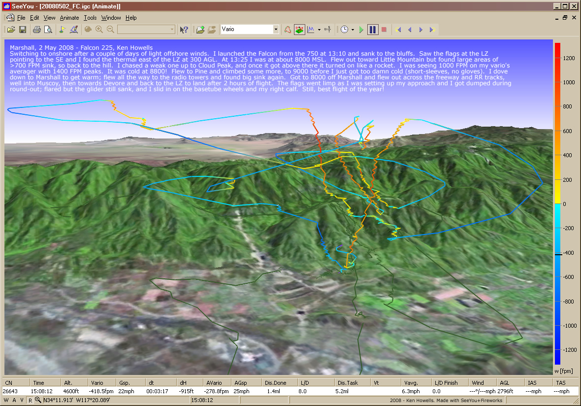
20080502: Marshall
M750 to 9000 MSL
M750 to 9000 MSL
1180 x 824
(447 KB)
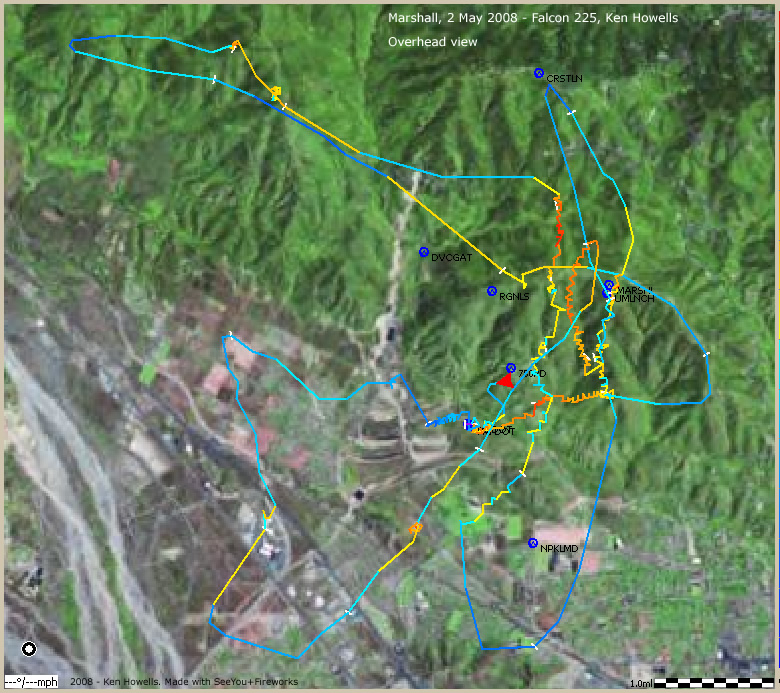
20080502: Marshall
Overhead View
Overhead View
780 x 693
(254 KB)
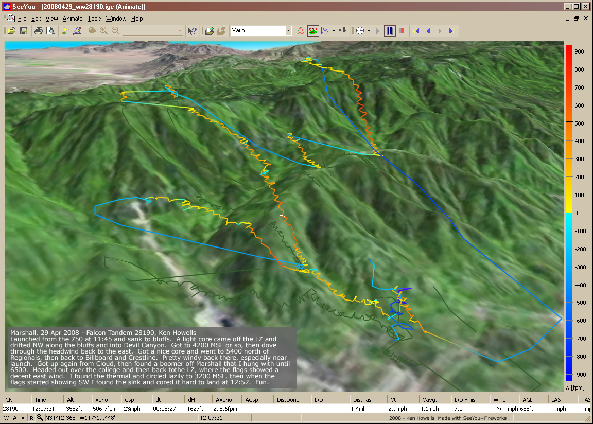
20080429: Marshall
1152 x 824
(369 KB)
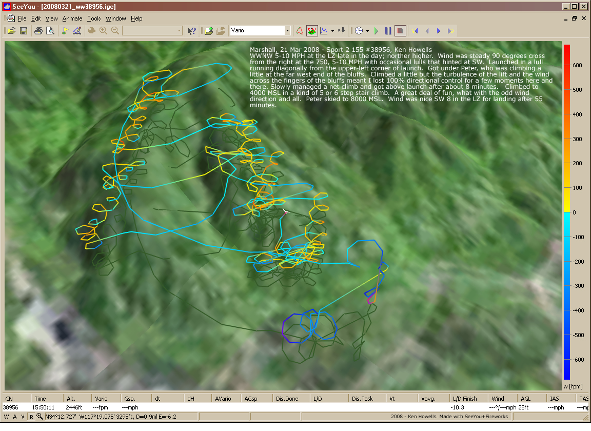
20080321: Marshall
1152 x 825
(595 KB)
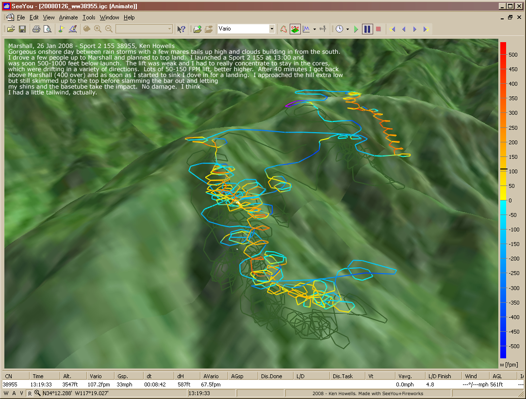
20080126: Marshall
1084 x 824
(559 KB)